The Story Behind 500 Hibernia

Present Day

  • Despite being designated as a priority for open space and agricultural preservation and easement by West Brandywine Township beginning in 1993, 500 Hibernia remains in the hands of Imaging Associates LLC, which has partnered with Toll Brothers in an attempt to push through a high density age-restricted residential development using a loophole in the West Brandywine Ordinance.
  • As of November, 2026, the Ordinance is in the process of being changed to remove the loophole, leaving one major task yet to be accomplished: stopping the Toll Brothers Development proposal from being approved. As the proposal was made prior to changing the Ordinance, it is not subject to the change.
Get Involved ↗

History

  • Old maps and historical references place 500 Hibernia at or near the center of a major Indian settlement.
  • In 1701, William Penn signed the Treaty of Amnesty with several local tribes including the Lenni Lenape.
  • In 1706, Penn granted the Lenape 1 mile east and west of the West Branch Brandywine Creek, including 500 Hibernia.
  • In 1714, Penn granted a huge tract of land overlapping the Lenape territory, including 500 Hibernia, to George Claypoole.
  • In 1793, Samuel Downing, the namesake of Downingtown, acquired 500 Hibernia and eventually merged it with what is today known as Hibernia Park.
  • 500 Hibernia was later acquired by famous industrialist Charles Burke.
  • 500 Hibernia has changed private hands multiple times since.
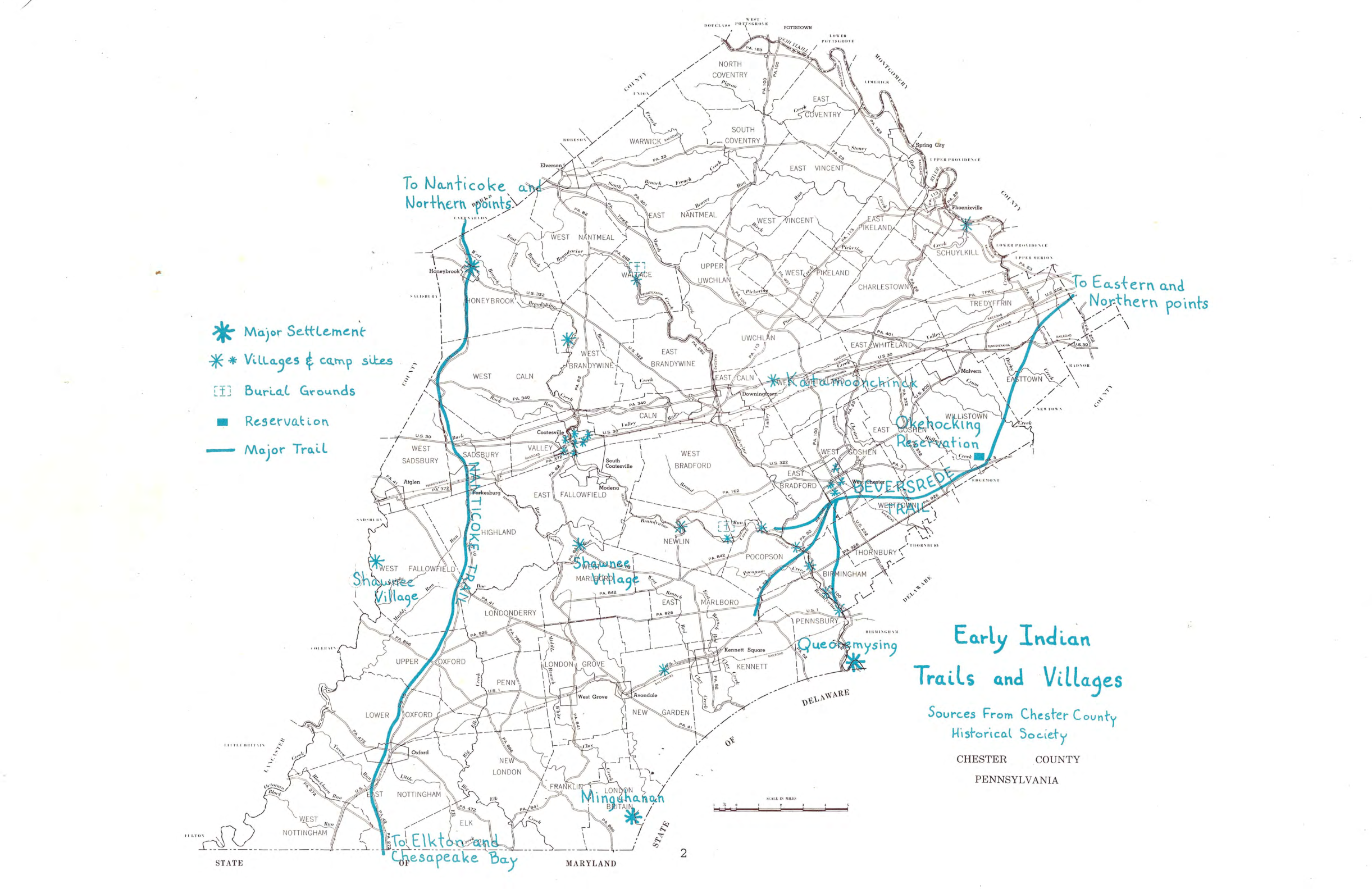
Download our Research to date on an Indian Presence at 500 Hibernia ↗
Early Indian Trails and Villages historical map from the Chester County Planning Commission atlas, with handwritten blue markings showing settlements, trails, and reservations.
Reproduction of Early Indian Trails and Villages map. Source: Chester County Planning Commission Historical Atlas. View full-size map ↗